
Carol Stream Neighbor Source Map
The block around an address crosses several record systems. DuPage GIS defines parcels and spatial adjacency. The tax portal gives parcel and billing context. Election tools return current precinct and district facts, while association sites describe their own developments. No source by itself proves who sleeps at an address or belongs to a household.
| Source | What it shows about a block | Access |
|---|---|---|
| DuPage Parcel Viewer | Parcel shapes, selected lots, buffer results, map layers | Free viewer; export options |
| DuPage property portal | PIN, tax year, legal description, billing and transfer context | Online search; office fallback |
| County election lookup | Precinct, polling place, ballot, overlapping districts | One-address secure search |
| Village Community Portal | Property, service, tax, government, and map categories | Address search |
| Association sources | Development name, public notices, meetings, stated coverage | Public page or direct request |
Use recorded owner, billing recipient, voter, association member, and occupant as distinct terms. Even when several fields point to the same name, retain the record date and role. That is the difference between a sound neighbor lookup and an unsupported household claim.
Buffer Carol Stream Neighbor Parcels
The DuPage GIS Parcel Viewer searches by a ten-digit PIN without dashes or by a partial property address. Once the parcel is selected, its Buffer tool starts at 250 feet and selects parcels that touch the chosen buffer. Layer visibility changes with map scale, and a parcel stays selected until it is cleared.
- Validate the address and choose its parcel in the viewer.
- Record the PIN, legal description, map date, municipality, and township shown.
- Set or confirm the buffer distance, then inspect the parcels touching that area.
- Export the selected set as TXT, CSV, PDF, XLS, or XLSX, and label the distance and date.
- Open each parcel's official property record only when its role is needed.
A buffer is spatial evidence only. It does not establish a family tie, shared ownership, friendship, association membership, or current residence. The tool can select up to 1,000 shapes, but a block question rarely needs a broad sweep.
Note: Repeat the buffer after a parcel-layer update because a split, combination, or map revision can change which parcels touch.
Reading Carol Stream Parcel Links
The DuPage parcel and address lookup accepts structured address parts. Rural-style addresses split the area prefix from the final street number. The successful manifest capture below shows the official lookup surface used to orient a block search.
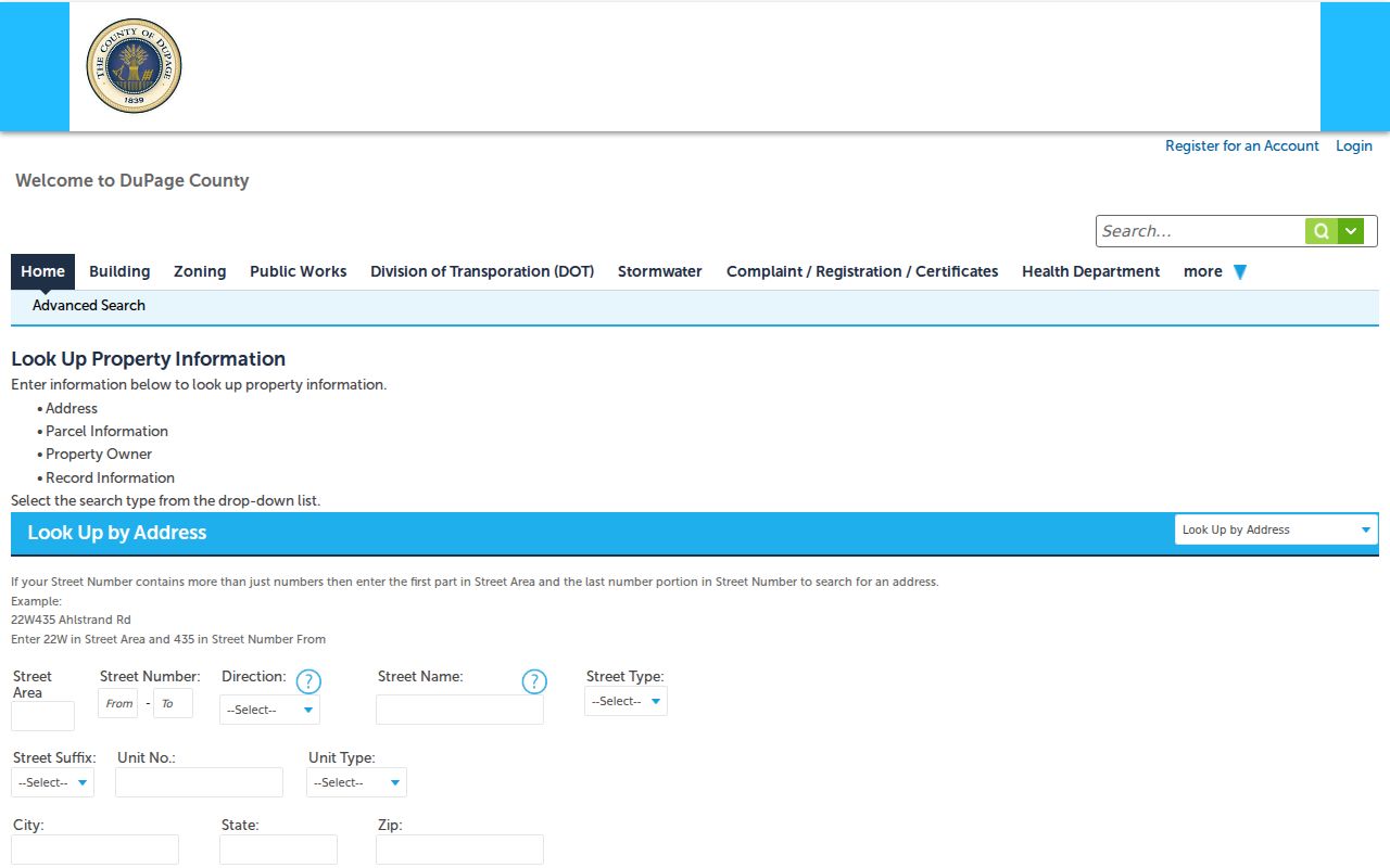
The form's separate street area, number, direction, name, type, unit, city, state, and ZIP fields explain why one free-text address may fail. Check the normalized address before mapping adjacent parcels.
A DuPage PIN is often displayed in grouped form, such as 06-20-303-014, while GIS expects the digits without hyphens. Property pages can show tax, assessment, transfer, exemption, appeal, split or combine history, legal description, map, and billing-related fields. Values must retain their tax year. A recorded owner or billing name is not proof of occupancy.
- Parcel
- A mapped unit of land identified for public records.
- PIN
- The county's parcel identification number; formats vary by portal.
- Legal description
- The recorded words that identify land, often by lot and subdivision.
- Buffer
- A measured zone drawn around a selected map feature.
Carol Stream's Three Township Overlay
One Carol Stream label can sit in Bloomingdale, Milton, or Wayne township records. That is a useful Profile 1 numbers and geography finding because it explains why nearby homes may return different tax or assessment contexts. The parcel record, not the postal city alone, should supply township and tax-district labels.
The Village comprehensive-plan map shows planning jurisdiction, village limits, unincorporated land, roads, rail, parks, and boundary agreements as of 2016. It is valuable historical context, but current parcel and municipal layers belong to County GIS. Save the date and layer name whenever a map supports a statement.
“Neighborhood” can mean an HOA, subdivision, postal label, precinct, township, school area, census geography, or an informal place name. Define which one is being used. Parks, schools, fire, library, water, and road layers may overlap the same block without sharing a boundary.
Carol Stream Blocks and Ballots
The DuPage election lookup can search one address with house number, street name, city, optional direction, and suffix. The result may show precinct, polling place, sample ballot, and representatives. It can also reveal city, township, county board, congressional, legislative, judicial, library, park, fire, and school districts.
Those outputs belong to an election cycle. Preserve the lookup date, election date, and ballot style. If the form rejects an address, enter the street name without its direction or type, then select the proper suffix. Call the Election Division if it still fails. Do not guess which precinct covers a Carol Stream block.
Illinois Election Code sections 4-8 and 4-33 restrict inspection, reproduction, signatures, and electronic voter data. Use the official tool for a defined election question, not to assemble a roster of neighbors. For past geography, request dated precinct maps, canvass records, district maps, or election-board minutes.
Carol Stream Community Directory Layer
The Village communication page links alerts, newsletters, public meetings, and a 2026 Neighborhood Roll Call feature, but research did not find a complete official association directory. Primary association pages can still document their own area. Verify status, street coverage, public contact, and page date before relying on one.
| Association source | Useful public context | Boundary caution |
|---|---|---|
| Easton Park HOA | Association news and development information | Not a village boundary or resident roll |
| Wheaton Oaks Townhome Association | Its own community notices and contacts | Development name may cross postal labels |
| Warrenville Lakes HOA | Its own area and public notices | Verify current parcel coverage |
The Easton Park HOA source produced the successful image capture below.
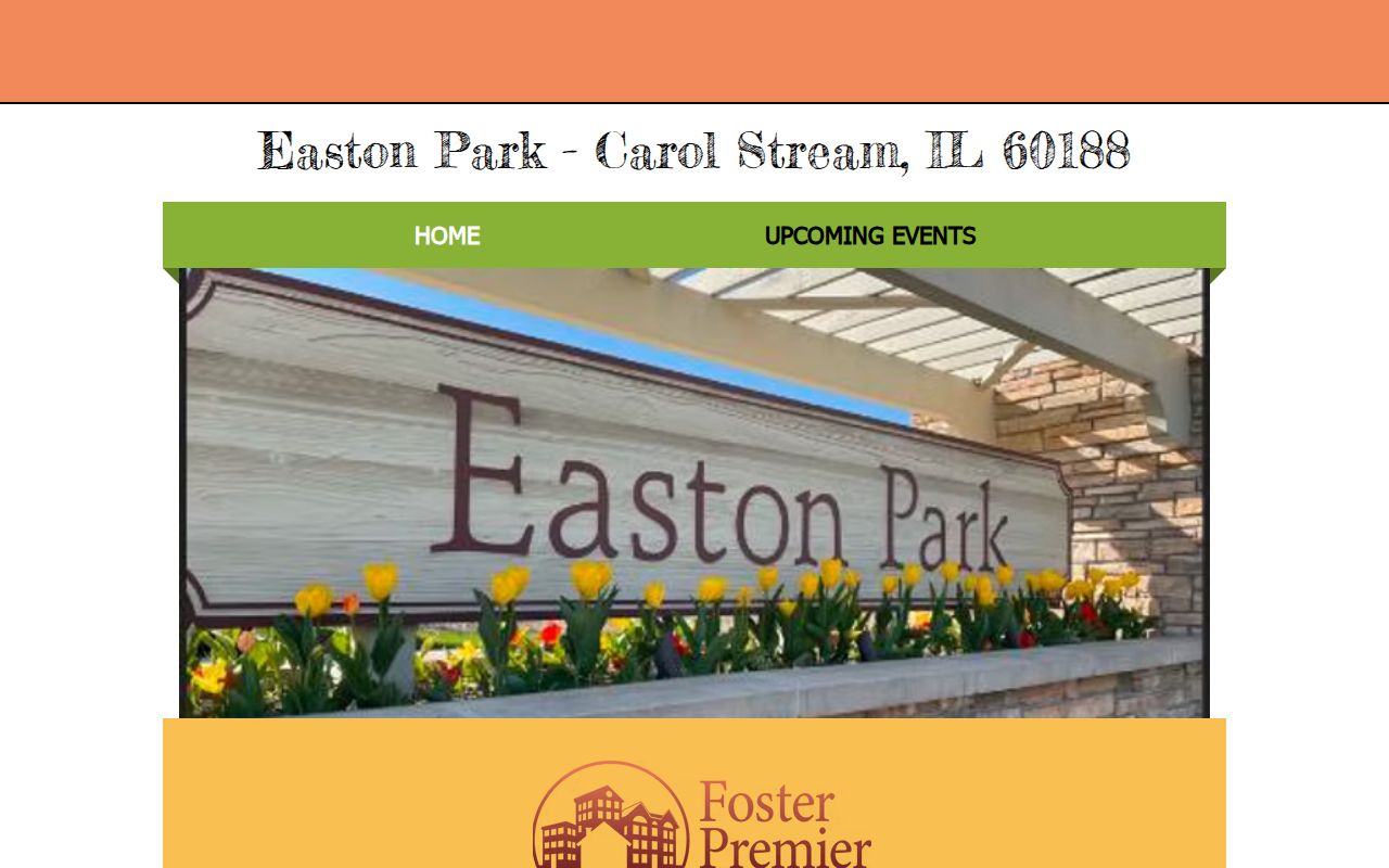
The association page adds community context only for its stated area. Compare that claim with a recorded plat, the subdivision or legal description, and County GIS. Never infer that a person belongs to an association solely from an address.
Official Carol Stream Block Evidence
Commercial neighbor tools often blend old addresses, inferred relationships, and data from unknown dates. Official sources are narrower, but each has a named keeper and a defined record purpose. That makes corrections and date checks possible.
| Question | Official roll or map | Commercial category |
|---|---|---|
| Where is the parcel? | County geometry with map date | May use an unexplained map source |
| Who is tied to the tax record? | Role and tax year are visible | May flatten owner, occupant, and past address |
| What can be corrected? | Named custodian and record process | Correction route may be unclear |
| What is the limit? | Source states its scope | Confidence may not be explained |
For an entire named road rather than the immediate radius, use the Carol Stream street directory. It follows the address chain without treating a buffer as a street-wide list.
Carol Stream's Civic Place Layer
The Great Western Trail and the Village path network give a block useful place context. Village research reports more than 23 miles of paths and trails, while the Great Western Trail spans 61 miles. Town Center at 960 N Gary Avenue, with ponds, a gazebo, and fountain, is another clear civic map label. These features orient a block but say nothing about a person.
Major routes such as North Avenue, Army Trail Road, St Charles Road, Geneva Road, Gary Avenue, County Farm Road, and Schmale Road help identify a street segment. Engineering files may add subdivision plats, easements, annexation agreements, right-of-way permits, drainage work, and infrastructure maps. Ask by street segment, intersection, parcel PIN, project, and year.
Recorded plats can be stronger than an informal neighborhood name. They show lots, road names, dedications, easements, and subdivision identity. Pair a plat with current GIS rather than treating a trail, park, school, church, or postal label as the edge of a neighborhood.
Privacy for Carol Stream Neighbors
Illinois FOIA permits redaction of private information and material whose release would cause a clearly unwarranted invasion of privacy. Utility and delivery data are not public household directories. Voter data has special limits. Parcel and tax fields describe land records, not every adult or child at a home.
The Illinois Address Confidentiality Program provides eligible survivors a substitute address for new public records and can protect voter information. Property records have separate limits, and no one should try to connect a protected address to a person.
Lawful use. Research Carol Stream neighbors for civic, historical, property, reconnection, or personal-safety needs. Never use maps or names to watch, harass, threaten, or pressure a person.
A careful block record names its source, role, date, and geographic meaning. Stop once the defined question is answered, and direct any correction to the agency or association that published the information.